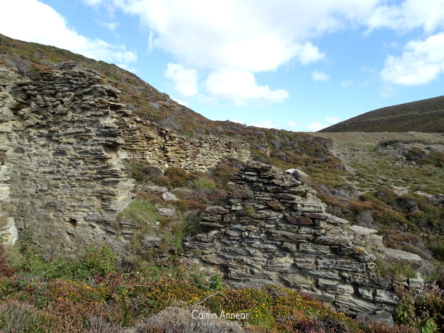
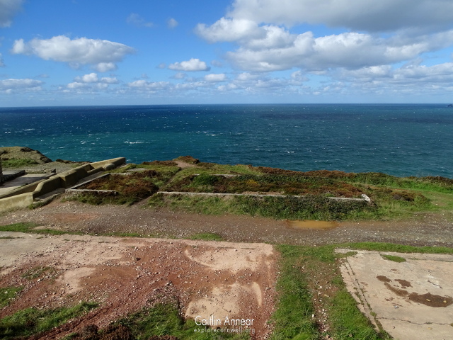
Wheal Lushington is a mine that over time stretched almost all the way from Portreath to Porthtowan and encompassed a large number of smaller mines. I’ve tried to get as complete a picture of this ancient workings, however their age and the constant overlap and changing of boundaries makes this difficult. Many of the supposedly separate workings below are basically the same mine, working the same lodes from the same shafts. Names in literature and on the abandoned mine maps also differ, for example Metal Works appears to be named Middleworks on the maps, but this could simply be a Cornish to English translation error. These separate ventures were all worked at slightly different times and included Wheal Fiddle, Wheal West, Wheal Sterran, Old Metal, Wheal Tobban, Wheal Vincent, Wheal Fox, Wheal Tye, Wheal Sally, Wheal Clarence, Cliff Down, Wheal Mary, Sparrow and Nancekuke.
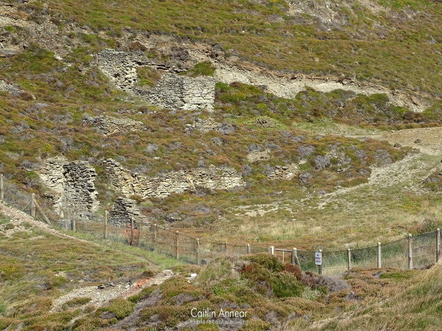
A number of the known lodes passed through the different mines, but development was sporadic. Records for this vast group of mines is little and irregular at best. Plans for the different setts start at around 1805, with output records beginning a little later.
In 1761, John Vivian of Camborne was given the land between Wheal Fox and Nancekuke village, including Wheal Vincent, Old Metal, Porthtowan Goasth and Wheal Mary. In 1807 a small section of the group was known as North Wheal Unity.
Wheal Sally
The closest member to Portreath, just inland from Kerriack Cove. Originally this was worked from a cliff adit and three shafts, but between 1920-25 this section was reopened to work Wheal Sally Lode. A new shaft, Sally’s Bottom, was sunk on an incline 257’ (78m) where miners found patchy areas of zinc, lead, chalcopyrite, galena and silver. Little came of this reworking.
Wheal West
Often the name given to the amalgamation of Wheal Sterran and Wheal Tye (and others over the years), this can be found on the headland just north of Wheal Sally and Kerriack Cove and worked two lodes: Wheal Sterran and South Wheal Sterran, which were renamed to Tye and Taylor’s in the 1850’s. Its most notable shaft is one of the most visible along the coastpath, the batcastle covered Kite’s which reached a depth of 61-fathoms (112m). Only one other shallow shaft is mentioned. Between 1852-81 519.5 tons (527,836kg) of black tin, 200 tons (203,209kg) of pyrite and 1.5 tons (1,524kg) of zinc were mined.
An engine house would have once stood south-east of Kite’s shaft, however, no remains of this can be seen today. A horse whim once sat to the north.
Wheal Sterran
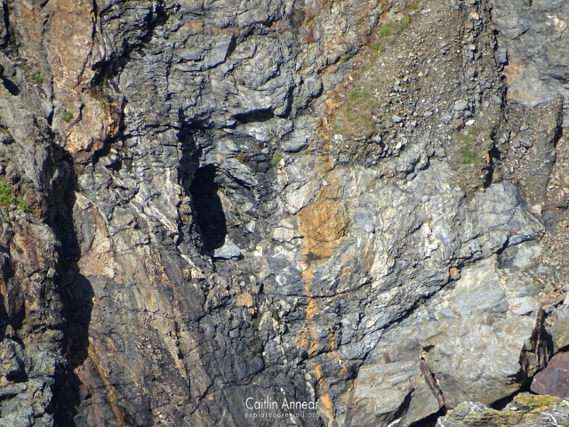
This mine was working by 1753, although it had been mined long before this, notable from a cave that is only accessible at low tide.
Wheal Tye
Worked several lodes, such as Wheal Vincent, Wheal Tye and Wheal Sterran lodes. At one point it may have had at least seven shafts and a whim engine, along with a changing house and smithy.
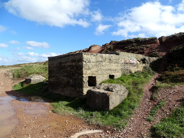
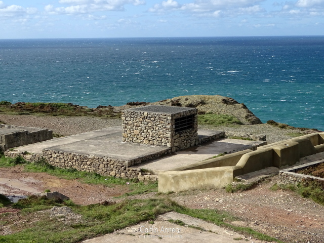
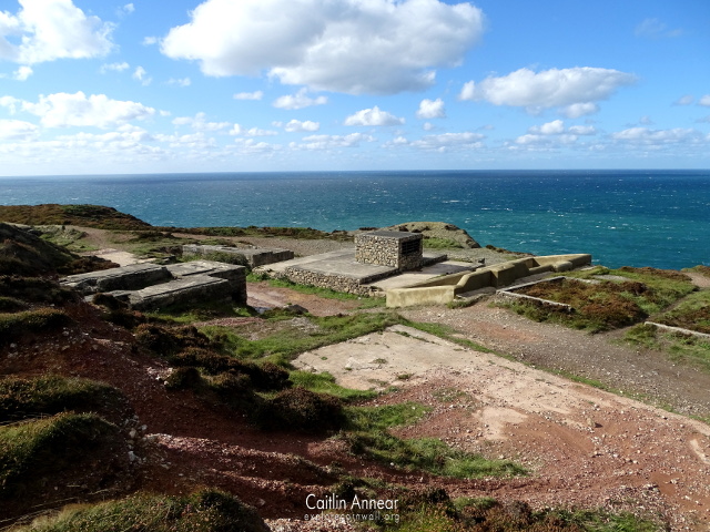
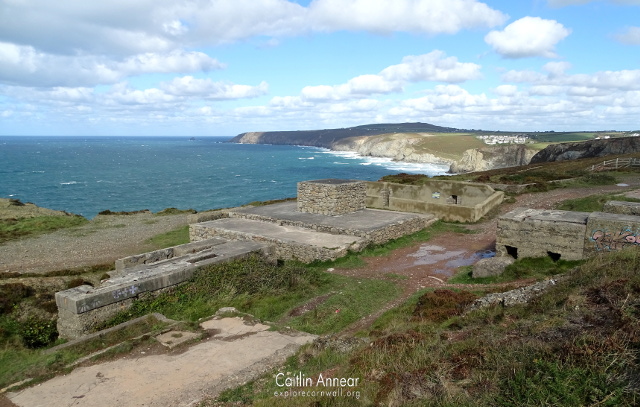
Wheal Sterran and Wheal Tye mines later amalgamated and worked together from Taylor’s and Tye’s lodes using four different shafts: Vivian’s (73-fathoms/134m), Caroline’s (45-fathoms/82m), London (38-fathoms/69m) and Eastern (26-fathoms/48m). In 1927 Vivian’s was reopened for further development, accounting for the numerous concrete structures surrounding the mine, but little happened, and the mine closed again. Lodes included Tye, Taylor’s, Goad’s, Langdon’s, Thomas’, Great South and Hampton’s.
Old Metal
This section was also worked from an adit at the base of the cliffs, along with a shaft that was dropped to 40-fathoms (73m) below this adit. The mine is another ‘old mine’ even when it was reopened in 1750 for both copper and lead, producing 42 tons (42,674kg) of copper in 1761.
Metal or East Towan
Situated on the cliffs south of Tobban Horse rock, this worked from Lead and Metal Work lodes using Metal Work or Ladder shaft (20-fathoms/37m) and Taylor’s shaft (84-fathoms/519m). Other known lodes include: Thomson’s or Thomas’, Great South, Lushington or Langdon’s, Hampton’s, Lead and North Lodes. One of its shaft had an engine which reached at least the 40-fathom (73m) level.
Wheal Tobban
The sett next to Old Metal is that of Wheal Tobban, which was worked from a cliff adit like many of its neighbours. This mine also worked for copper and lead, producing 6 tons (6,096kg) of galena (lead sulphite) in 1759.
Wheal Vincent
Further east of Wheal Metal Work is this venture which worked from five shafts and a cliff adit. Plans show small developments around the adit on two unknown lodes, although one may have been Wheal Towan lode, but no significant action from the shafts.
Wheal Fox
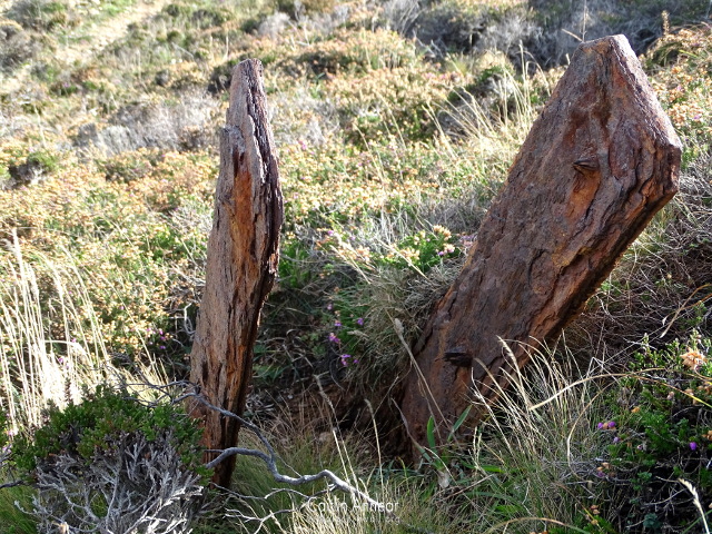
Originally on the headland just west of the Porthtowan river, this small working mined Wheal Fox, Little Fox and South lodes. Only one shaft is named, a whim (43-fathoms/79m), but it appears to have used more over time.
Wheal Mary
Situated south of Wheal Fox is Wheal Mary, also known as Wheal Clarence or Nancekuke and included Cliff Down mine. A number of lodes were said to pass through this sett, including Towan Coath, Wheal Towan, Lead and North Grambler, but plans show little development. Shafts include Lushington Engine or Reynolds (87-fathoms/159m), Towan Coath, Goyn’s, Whim, Wheal Mary, Mitchell’s or Nelson (41-fathoms/75m) and Whim. Four air shafts are shown on plans, but unnamed.
Plans show that at some point Wheal Mary was connected with another neighbour, Sparrow mine. Three adits are also named: Wheal Mary Adit, Wheal Mary Shallow Adit and Bluff Adit.
Cliff Down mine produced 316 tons of 6% copper between 1823-41 and Wheal Clarence mined 67 tons (68,075kg) of 3% copper sporadically between 1835-66. As Nancekuke mine, 40 tons (40,641kg) of black tin, 747 tons (758,987kg) 67% copper and 13,706 oz (388kg) silver were mined.
Wheal Lushington
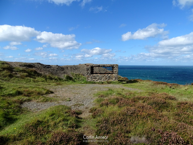
Often used as the collective name for may of the mines at one time of another, this section can be found right on the west valley side of Porthtowan. Judging from the significant crossovers with Wheal Mary, this mine probably occupied the same space.
Part of this was a Wheal Lushington Adit which connected with Wheal Lushington Engine shaft and worked Wheal Towan lode. Another adit was the Bluff Adit which connected with Nelson’s shaft which may have had its own engine at one point. At one point in time there was a mill on this section named Allen’s mill, complete with waterwheel as well as a stamps further up the valley.
Wheal Sparrow
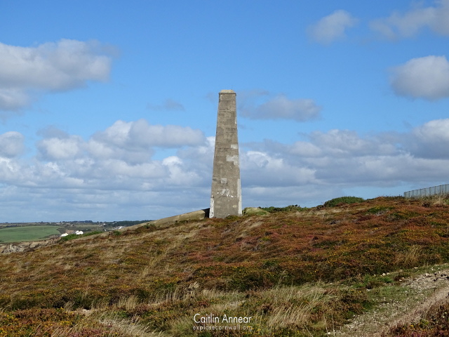
This mine is the last of the group and was found south of Wheal Mary. It’s workings were covered over time by Porthtowan village but would have once worked several lodes: Wheal Clarence Copper, Willow’s or Witlow’s, North Part United Hill’s, South Part United Hill’s, Lead and Wheal Sparrow lodes. Between 1829-41 2,227 tons (2,262,736kg) of 6.5% copper ore was mined.
Shafts used to mine these lodes include: Footway (28-fathoms/51m), Valley (40-fathoms/73m), Skew’s (28-fathoms/51m), Middle (16-fathom/29m), South (16-fathom/29m) and New South (82-fathoms/150m).
Wheal Fiddle
I could only find one mention of this, in Hamilton Jenkin, and could find no evidence of it on the maps. This sett was granted in 1773 and had at least a 50-fathom (91m) long adit.
Wheal Lushington Engine
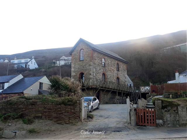
The only remaining engine house is found in the Porthtowan valley and dates from 1872 when the sett was reworked as New Wheal Towan. This was built to house a rotative pumping engine that was bought second hand from Ireland to pump out of an adit behind the house; however it was never installed before the mine closed again. The building has since been converted into first a cafe and now a house.
Wheal Sally Section
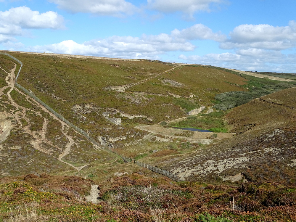
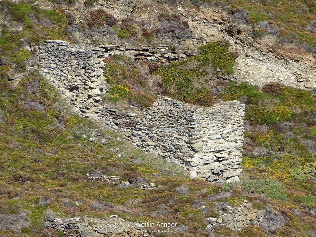
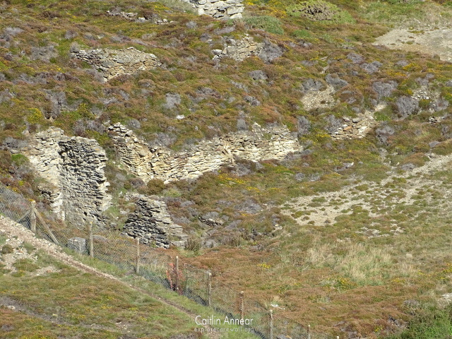
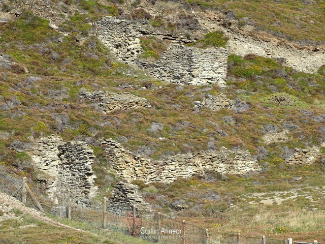
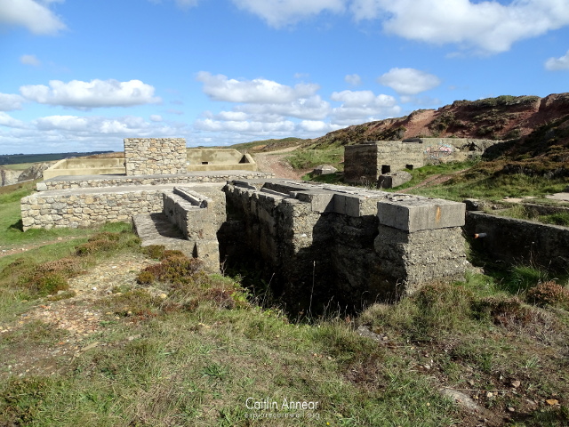
Behind the MoD fence sits the remains of a stamps engine and two reservoir ponds.
Access to the vast majority of the old workings is available along the coastpath. Only a small number of buildings, mostly around the Wheal Sallys section, are behind the MoD fence.
There are facilities at either end of the coastpath in the villages of Portreath and Porthtowan.
Parking can be found at either end of the coastpath at Portreath and Porthtowan.
Acton, B. (2005) Around Perranporth, St Agnes and Portreath. Truro: Landfall Publications.
Buck, C. (1998) Shaft Capping Contract 11. Available at: http://map.cornwall.gov.uk/reports_event_record/1998/1998R002.pdf (Accessed: 25 September 2018).
Dennis, H. (1853a) ‘Surface and underground plan, Wheal Lushington, MRO/R200/22’. Kresen Kernow. Available at: https://kresenkernow.org/SOAP/detail/9017a750-6712-4af2-8b30-d0035ee6df00/?tH=%5B%22MRO%7CR200%7C2%22%5D.
Dennis, H. (1853b) ‘Underground sections, Wheal Lushington, MRO/R200/23’. Kresen Kernow. Available at: https://kresenkernow.org/SOAP/detail/70fdf40d-1366-46ad-9b4e-9b42bde29014/?tH=%5B%22MRO%7CR200%7C2%22%5D.
Dines, H. G. (1956) The metalliferous mining regions of south-west England. British Geological Survey.
Hamilton-Jenkin, A. K. (1963) Mines and Miners of Cornwall: X Camborne & Illogan. Truro: Truro Bookshop.
‘Surface and underground plan, West Wheal Towan, Illogan, HB/A40/1’ (no date). Kresen Kernow. Available at: https://kresenkernow.org/SOAP/detail/b26b3871-f741-4ac9-ac74-a1bbd257a1e0/?tH=%5B%22lushington%22%5D.
‘Surface and underground plan, Wheal Lushington, MRO/R200/4’ (no date). Kresen Kernow. Available at: https://kresenkernow.org/SOAP/detail/1f8dfb1a-9d48-4ed3-a42e-a7ffec4887e5/?tH=%5B%22MRO%7CR200%7C4%22%5D.
‘Surface and underground plan of Wheal Buff adit, MRO/R200/19’ (no date). Kresen Kernow. Available at: https://kresenkernow.org/SOAP/detail/3f110e28-d8ce-4d26-9503-e5639c4e3579/?tH=%5B%22MRO%7CR200%7C19%22%5D.
‘Surface plan, West Wheal Towan, Illogan, X560/29’ (no date). Kresen Kernow. Available at: https://kresenkernow.org/SOAP/detail/c46374af-880e-440d-9b5d-469c62c7293f/?tH=%5B%22lushington%22%5D.
‘Underground and surface plan, Wheal Lushington, MRO/R200/7’ (no date). Kresen Kernow. Available at: https://kresenkernow.org/SOAP/detail/cd055f10-d4ff-4586-b6ff-df83d14517f8/?tH=%5B%22lushington%22%5D.
‘Underground plan of Wheal Fox, MRO/R200/29’ (no date). Kresen Kernow. Available at: https://kresenkernow.org/SOAP/detail/cc52d59f-6f4d-4933-ae53-82edecb94c94/?tH=%5B%22lushington%22%5D.
‘Underground section, Wheal Lushington, MRO/R200/5’ (no date). Kresen Kernow. Available at: https://kresenkernow.org/SOAP/detail/f6575e6b-e9c2-45cd-9fdf-6d720685fdad/?tH=%5B%22MRO%7CR200%7C5%22%5D.
‘Underground section of Wheal Buff adit, MRO/R200/2’ (no date). Kresen Kernow. Available at: https://kresenkernow.org/SOAP/detail/9517fb94-d05b-4ae3-8238-089683ed88b0/?tH=%5B%22MRO%7CR200%7C2%22%5D.
