West Penwith has one of the greatest densities of heritage in all of the UK, and this walk aims to take in just some of it. From Carn Galver mine its possible to walk across the moors to Ding Dong mine near Madron, with numerous megalithic structures on the way.
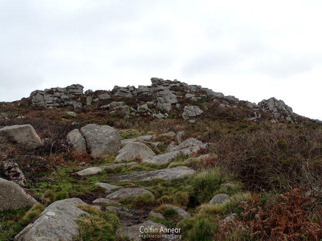
Starting off at the magical Carn Galver, a predominantly 19th century tin and copper mine. On the other side of the road is a narrow and very steep track heading up Carn Galver. Carn meaning a heap of stones in Cornish, its not dissimilar to others around the county such as Carn Marth, Carn Brea or the closer Carn Kenidjack.
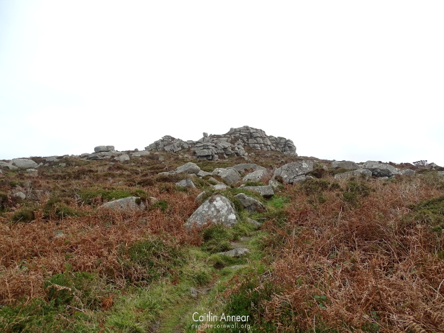
This is the path that a friend and I took up to the peak of Carn Galver, although there is an alternative route slightly further down the road we took on the way back that is much more flat.
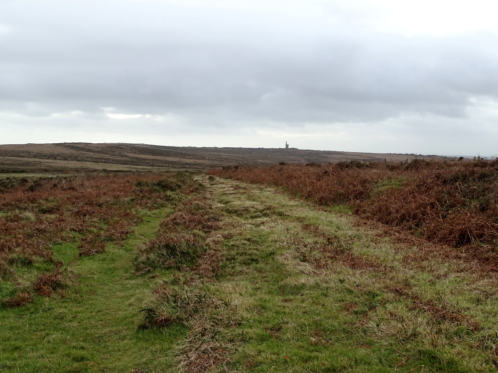
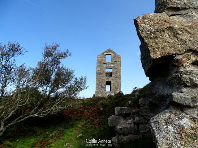
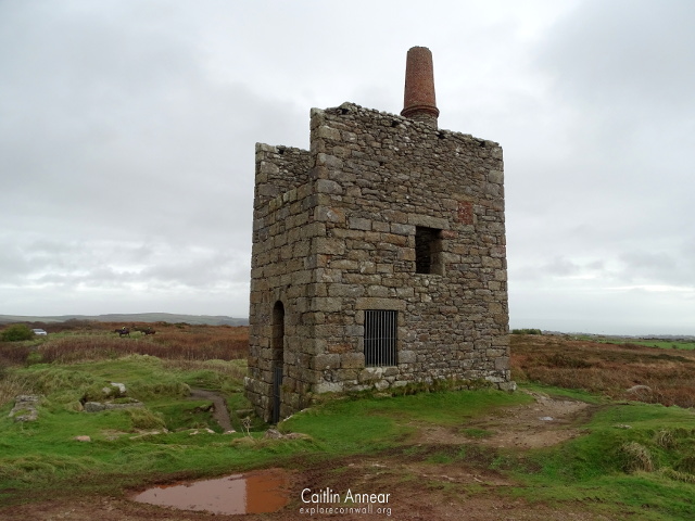
Once at the top we got our first view across the moors to the distance outline of Ding Dong mine’s Greenburrow engine house. After ambling down the other side of the carn and dodging lots of deep puddles, we joined the lower path and continued on towards the mine.
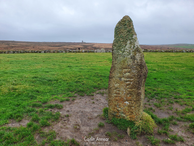
After passing a ruined farm building on the right, carry straight on at the rather scew-wiff crossroads. At this crossroad, half buried in the mud is the ‘rock of four parishes’, a marked stone that marks the boundaries of the parishes of Gulval, Madron, Morvah and Zennor.
The day we walked it was definitely on the moist side, having to spend more time on the ridges around the path then on them to avoid very large puddles. Eventually we reached the engine house, although not until after my friend had slipped and fell in the mud, and took in the amazing views. Even with the bad weather we could still see all of the beautiful farmland around us.
From here there are two choices on how to return back (or do both, entirely up to you).
Choice One
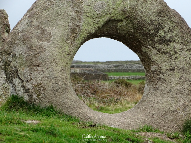
Facing back towards Carn Galver, if you follow the path back until it branches back the way you came and a second left hand path. Take this second path until you reach a stile. Over the stile, follow the muddy path around to the left and down the hill. On the left are remains of old mine workings all fenced off. At the bottom of the hill, cross over the stream and if the weather is bad you may have to cross a number of other less official streams as the ground heads up again. Soon you’ll reach the open patch of ground with Men-an-Tol in the centre; this is an ancient site steeped in history thought to be around 2,500 to 1,500 years old. After this, hop over the gap in the wall opposite and turn right up the footpath. This eventually reaches the previously visited scew-wiff crossroads, but not before passing Men Scryfa.
Men Scryfa is a free standing stones possibly dating from 500-700CE; inscribed with ‘rialobriani cvnlvali’, although more lettering is buried, this likely translates to ‘the stone of Riabolbranius, on son Cunovalus’.
Choice Two
Instead of heading left, follow the wide path from the engine house to the right. On reaching a farm gate post, turn left up a narrow uphill track. This track winds its way up to Boskednan Stone Circle, a Early Bronze Age (2500-1500 BCE) circle made up of thirteen standing stones.
Once you’ve had your fill of the circle, stay on the path, which will eventually make its way to the crossroads. From here you can either go right back to the car, or straight on and see Men-an-Tol.

All parts of the walk are free to all along public footpaths and open access land. Many of the paths we walked were narrow, uneven and severely water logged, so wellies in winter are a must. Those with mobility issues may struggle.
There is parking available for free at Carn Galver mine.
Boskednan stone circle (2018). Available at: https://www.cornwall.gov.uk/environment-and-planning/strategic-historic-environment-service/cornwall-and-scilly-historic-environment-record/access-to-monuments/find-by-name/find-monuments-by-name/a-e/boskednan-stone-circle/.
Historic England (2020) Men Scryfa. Available at: https://historicengland.org.uk/listing/the-list/list-entry/1018573.
Four Parishes Rock (2020). Available at: https://www.megalithic.co.uk/article.php?sid=48125.
Preston-Jones, A. (1993) Men-an-Tol. Available at: https://map.cornwall.gov.uk/reports_event_record/1993/1993R010.pdf.